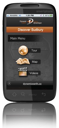
A new smartphone app designed to guide tourists, visitors and residents to sites of interest in the Sudbury area is proving just as popular with armchair tourists around the world.
A beta version of the free Discover Sudbury app was released in October 2011 and, as of the official launch in April, there were already 1,000 downloads form 25 countries, including China, Russia, Indonesia and Kuwait.
“I don’t know if they’re ex-Sudburians or people just interested in geology,” said Mia Boiridy, director of Dynamic Earth, Sudbury’s geoscience centre and an attraction of Science North.
The app, which is available for the Apple, Android and Blackberry platforms, and produced in partnership with the City of Greater Sudbury, launches with a dramatic, three-minute video describing the impact of a 10 kilometer-wide meteorite that smashed into the Earth’s crust 1.85 billion years ago, creating rich nickel, copper and precious metal deposits from the melt rock.
Another video traces the modern history of the Sudbury Basin, from the discovery of copper and nickel ore in the 1880s during the construction of the trans-Canada railway, to the emergence of today’s prosperous municipality.
The app guides users to 12 locations in the Sudbury area to explore the geological, mining and cultural history of the city. At the A.Y. Jackson Lookout, for example, the app points users to a sample of a distinctive rock known as Onaping Fallback Breccia and to an air-powered mucking machine used in the early days of mining.
Other locations point out shatter cones, which are thought to provide proof of the meteorite impact; the site of the roast yards, where nickel and copper ore was roasted in large logpiles; and the 381-metre Superstack, built in 1972 to disperse emissions from the Copper Cliff smelter. Photographs accompany the explanatory text, “so visitors know what they’re looking at,” and “fun facts” provide tidbits of information for trivia enthusiasts.
The app’s integrated mapping functionality takes advantage of smartphone GPS technology to direct users to each location, even telling them where to park.
Dynamic Earth is also working with Natural Resources Canada on a series of geotours for the Highway 400 and 17 corridors to Wawa and the Highway 11 corridor to Timmins, said Boiridy.
At some point, these, too, could be transformed into apps, she said.
The Discover Sudbury app can be downloaded from the Dynamic Earth website and the Apple, Android and Blackberry online app stores, or by using the QR code above.
Visitors who aren’t as technologically up-to-speed can still opt for a conventional Discover Sudbury tour by Dynamic Earth guides, although a fee applies.


