 The Northern Ontario forest industry has used aerial photography and geomatics as planning tools for years. Now, a Thunder Bay-based business is also introducing these services to exploration and mining companies.
Since 1973, KBM Resources Group has operated as one of the largest forestry consulting firms in Ontario. KBM managing partner Laird Van Damme said that as a result of the recent decline of the forest industry, the company has been re-inventing itself and diversifying to expand its customer base. KBM, which employs a staff of 20, has switched its focus to mining and provides aerial photography, GIS, geomatics and map making services to mining and exploration companies. It also provides similar services for companies in the solar, wind and biomass energy industries.
Approximately 25 per cent of the company’s business is still focused on forestry, but the mining and renewable energy industries now account for the majority of KBM’s work.
“The survival mechanism in the current recession is to diversify,” said Van Damme, a professional forester.
The company recently changed its name from KBM Forestry Consultants Inc. to KBM Resources Group to reflect its broadened customer base.
Van Damme said he believes the future looks bright for exploration and mining in northwestern Ontario, attributing his optimism to developments in the Ring of Fire and the current high price of gold.
KBM’s aerial photography customers are mainly based in northwestern Ontario, the Prairie provinces, Minnesota and Wisconsin.
“We’ve developed a certain niche in terms of the types of products we provide, and we’re regionally focused,” said Van Damme.
KBM helps companies and organizations transform raw images into accurate geospatial data through its digital aerial photography and interpretation services. The company provides geographical information system (GIS), image analysis and spatial modelling services.
KBM has been offering digital colour aerial photography services for a variety of uses in the forest industry, including property assessment, forest depletion mapping and inventory updating, and is now offering the service to exploration and mining companies. The company uses global positioning system (GPS) planning, tracking and navigation software to provide multiple scales and resolutions for digital aerial photography.
Clients include Sabina Resources, Landore Resources, Ontario Power Generation, the City of Thunder Bay, AbitibiBowater and the Ontario Ministry of Natural Resources.
“Mining companies need to have good maps to work with for exploration, development and reclamation projects,” said Van Damme. “There’s a need for good mapping for all phases of mining.”
KBM maps can help mining and exploration companies select campsites, mobilize drill rigs and monitor stockpiles. They can also be used for permitting and environmental assessment purposes.
KBM’s geomatics department has more than 20 years of experience in remote sensing and GIS, and has developed a working relationship with Lakehead University, where the company sponsors research and leases geomatics lab space.
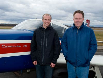
Aerial photographs of specific sites are taken automatically using a medium-format camera, which captures high-resolution colour photos. KBM currently uses two airplanes, a single-engine and a twin-engine plane, to capture images from the sky.
Once the photos are taken, they can be connected into a virtually seamless ortho-rectified mosaic and aerial map of the overall area.
“It gives more information than a regular map does,” said Van Damme.
KBM is able to create accurate digital elevation models. The models provide bare earth, surface and spot elevation data, and are used for identifying contours. Government-issued topographical maps show contour intervals representing every 10 metres, and use symbols to identify forests or water bodies, whereas KBM maps identify contour intervals of less than a metre and show the actual trees, said Van Damme.
Being based in Thunder Bay gives KBM an advantage over competitors from outside the region “because we can play the weather better,” he said. Satellite imaging is another option for resource companies, but it, too, is dependent on the weather.
“We can fly under the clouds or between the clouds and provide higher resolution. Plus we’re less expensive, so we’ve found a real sweet spot,” said Van Damme.
KBM also creates image backdrops for use with existing GIS layers, and on-screen digitizing of new data in 3D or 2D formats. The company makes custom maps, hydrological models, and collects GPS field data. Multiple-stereo workstations are used for softcopy photogrammetry and GIS applications.
Van Damme said faster turnaround time, better image quality, and lower production costs are some of the benefits of mapping in the digital age.

